|
Designated as a European Marine
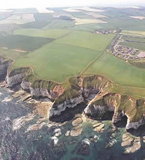
site of considerable importance, the sub-sea area off Flamborough
Head is unique in terms of the total area of submerged chalk reef
systems that it supports. These are valued for their rarity and
the particular types of faunal associations and habitats that exist
amongst them.
The near-shore littoral and circa-littoral
zone has bands of intact bedrock with submerged sea caves, underwater
ravines and tall vertical faces. The offshore area exhibits extensive
low-lying reef areas with terraced bedrock and rich faunal turf
The sub-littoral reef system was known to extend
out to beyond 10 km offshore, but the extent of coverage in terms
of area and zonation was not known precisely. In order to provide
a basis for quantitative monitoring of the site's conservation status,
English Nature required detailed maps of the reef system and the
various seabed habitats and biotopes associated with them.
Hydrosurveys were awarded the
contract to survey a sub-sea area of some 10,000 ha, using a combination
of sidescan imaging, acoustic ground discrimination (AGD), and single
beam echo-sounding.
(Contd down)
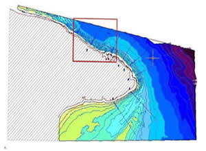
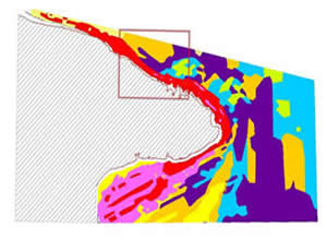
After the field surveys had been completed, the
immense task of interpreting and bringing together the various data
sets commenced. Seabed bathymetry around the Flamborough headland
(above) was interpreted in conjunction with the acoustic ground
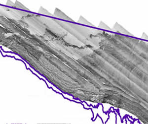
discrimination plot of habitat zones (above right). Sidescan images
(right) were used for simultaneous visual assessment of the geology
and physical nature of the reef system.
The figure to the right shows a small part of the
overall sidescan mosaic and is taken from the rectangular area inset
above.
Dive and video 'drop' surveys were used to provide
ground-truth data for discrimination of different substrates and
habitat types within both the AGD footprint and the sidescan images.
|